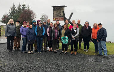
Crow Pass Cabin
Region: Southcentral Region · Nearest Stop: Girdwood
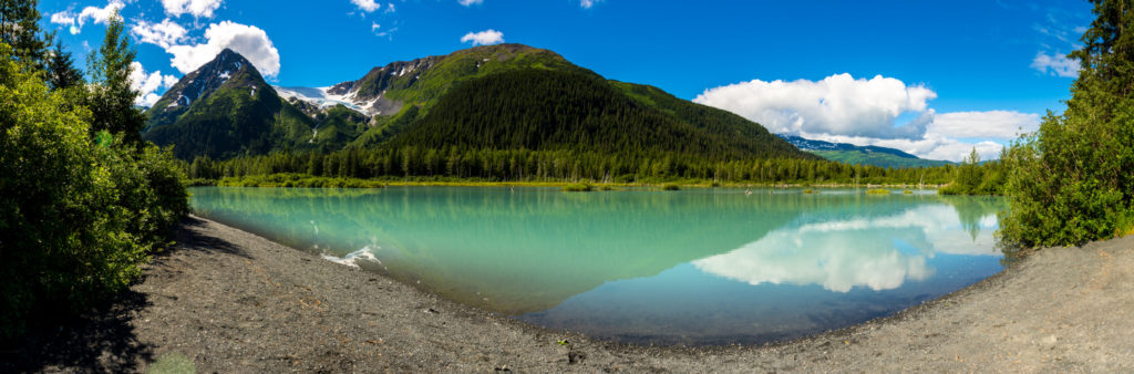
Perched high in alpine tundra near Raven Glacier and Crystal Lake at Crow Pass (3,500 ft) along the Chugach National Forest Southern Trek above Girdwood.
Reservation Status:*Reservations required via Recreation.gov
Managing Partner:U.S. Forest Service (Chugach National Forest)
Eagle River Nature Center Cabins & Yurts
Region: Southcentral Region · Nearest Stop: Eagle River
Public-use cabin and three backcountry yurts managed by the non-profit Friends of Eagle River Nature Center along the Historic Iditarod (Crow Pass) Trail in Chugach State Park.
Reservation Status:*Reservations required via ernc.org (1 cabin & 3 public yurts)
Managing Partner:Eagle River Nature Center / Chugach State Park
Historic ARC Cabin (Skwentna Crossing)
Region: Interior / Rivers Region · Nearest Stop: Skwentna
Historic Alaska Road Commission (ARC) shelter cabin corridor west of Skwentna on the approach toward Finger Lake and the Happy River Steps.
Reservation Status:No reservation required · First-come emergency/public winter shelter
Managing Partner:Alaska Department of Natural Resources (AK DNR)
Rohn Public Safety Cabin
Region: Interior / Rivers Region · Nearest Stop: Rohn
Iconic BLM log safety cabin at the confluence of the Tatina and South Fork Kuskokwim Rivers, immediately after the treacherous descent through Rainy Pass (3,200 ft) and Dalzell Gorge.
Reservation Status:Open year-round · No reservation required (shared emergency shelter)
Managing Partner:Bureau of Land Management (BLM Anchorage Field Office)
Bear Creek Public Safety Cabin
Region: Interior / Rivers Region · Nearest Stop: Nikolai
Located between the Farewell Lakes / Buffalo Tunnels segment and Nikolai on the northern flank of the Alaska Range along the South Fork Kuskokwim corridor.
Reservation Status:Open year-round · No reservation required
Managing Partner:Bureau of Land Management (BLM)
Carlson Crossing Safety Cabin
Region: Interior / Rivers Region · Nearest Stop: Takotna / Ophir
Public winter shelter cabin in the upper Innoko / Takotna gold-rush country northwest of Takotna and Ophir.
Reservation Status:No reservation required · Public winter trail shelter
Managing Partner:Alaska Department of Natural Resources / IHTA
N. Fork Innoko Safety Cabin
Region: Interior / Rivers Region · Nearest Stop: Cripple
Remote shelter cabin along the North Fork of the Innoko River near the Cripple segment on the Northern Route between Ophir and Ruby.
Reservation Status:No reservation required · Public winter trail shelter
Managing Partner:Alaska Department of Natural Resources / IHTA
Tolstoi Headwaters Safety Cabin
Region: Interior / Rivers Region · Nearest Stop: Dishkakat / Ophir
Situated in the Tolstoi Creek headwaters between Ophir and the abandoned Innoko River trading post of Dishkakat.
Reservation Status:No reservation required · Public winter trail shelter
Managing Partner:Alaska Department of Natural Resources / IHTA
Historic ARC [Don's] Safety Cabin
Region: Interior / Rivers Region · Nearest Stop: Iditarod / Dishkakat
Named in honor of legendary Alaska trailblazer Dononer/Don (“Don’s Cabin”) along the historic Alaska Road Commission corridor between Ophir, Dishkakat, and Iditarod.
Reservation Status:No reservation required · Public winter trail shelter
Managing Partner:Alaska Department of Natural Resources (Historic ARC)
Moose Creek Safety Cabin
Region: Interior / Rivers Region · Nearest Stop: Iditarod / Flat
Located along the Moose Creek divide on the approach to the ghost towns of Iditarod, Flat, and Otter in the Innoko mining district.
Reservation Status:No reservation required · Public winter trail shelter
Managing Partner:Alaska Department of Natural Resources / IHTA
Big Yentna Crossing Safety Cabin
Region: Interior / Rivers Region · Nearest Stop: Shageluk / Anvik
Shelter cabin on the remote lowland portage between the Iditarod River country and the Innoko/Yukon River villages of Shageluk and Anvik.
Reservation Status:No reservation required · Public winter trail shelter
Managing Partner:Alaska Department of Natural Resources / IHTA
Tripod Flat Public Safety Cabin
Region: Bering Sea Coast · Nearest Stop: Kaltag
First of two BLM public safety cabins along the ancient 90-mile Kaltag-to-Unalakleet Indigenous portage trail through the Nulato Hills.
Reservation Status:Open year-round · No reservation required
Managing Partner:Bureau of Land Management (BLM Central Yukon / Anchorage)
Old Woman Public Safety Cabin
Region: Bering Sea Coast · Nearest Stop: Unalakleet
Historic BLM shelter cabin near Old Woman Mountain at the halfway point of the Kaltag Portage between the Yukon River and Unalakleet on Norton Sound.
Reservation Status:Open year-round · No reservation required
Managing Partner:Bureau of Land Management (BLM)
Foothills Public Safety Cabin
Region: Bering Sea Coast · Nearest Stop: Shaktoolik / Unalakleet
Provides life-saving wind protection in the exposed Blueberry Hills / Egavik foothills between Unalakleet and Shaktoolik along eastern Norton Sound.
Reservation Status:Open year-round · No reservation required
Managing Partner:Bureau of Land Management (BLM)
Topkok Mushers Safety Cabin
Region: Bering Sea Coast · Nearest Stop: Solomon / White Mountain
Built and maintained with the historic Nome Kennel Club (founded 1907) near the infamous Topkok Blowhole between White Mountain and Solomon on the final stretch to Nome.
Reservation Status:No reservation required · Emergency coastal blizzard shelter
Managing Partner:Nome Kennel Club / AK DNR / IHTA