Iditarod Historic Trail Alliance · Preserving Alaska's 2,400-Mile National Historic Trail Network

Communities & Settlements Along the Trail

From Mile 0 on Resurrection Bay in Seward across the Chugach and Alaska Ranges, down the Yukon River, and across Norton Sound to Nome, explore the 18 historic settlements and living communities connected by the Iditarod National Historic Trail.

Seward along the Iditarod National Historic Trail
Stop 01 · Southern Trek · Mile 0

Seward

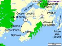
Seward is located on Resurrection Bay, named in 1792, by Alexander Baranof, the Alaska manager of the Russian American Company, while he was exploring the Kenai Peninsula for possible sites for ne settlements. It is said that he named the b…
Mile 1 in Seward along the Iditarod National Historic Trail
Stop 02 · Southern Trek · Mile 1

Mile 1 in Seward

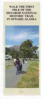
In 2017, the Seward Trailblazers published a brochure to guide visitors along the first mile of the Iditarod National Historic Trail in Seward, Alaska. The first mile is an easy walk along the 26-year-old bike path which starts at the Trail…

Stop 03 · Southern Trek · Kenai Mountains

Moose Pass

The community was first named in 1912 as a station on the Alaska Railroad. The name is reportedly derived from a mail carrier's team of dogs that in 1903 had considerable trouble gaining the right-of-way from a moose. A post office was esta…

Stop 04 · Southern Trek · Turnagain Arm

Girdwood

The Town was originally named Glacier City and acted as a gold mining and railroad supply camp in the early 1900s. Later it was renamed "Girdwood" in honor of James Girdwood, a Irish entrepreneur who came in 1896 and bought 4 mining claims …

Stop 05 · Southern Trek · Chugach

Eagle River

The Eagle River , Peters Creek, and Eklutna Lake areas were the hunting areas of the Athabascan Natives from the Eklutna and Matanuska villages. They hunted sheep, goat, and moose in the mountains. Fish were caught in the latter part of May…

Stop 06 · Southern Trek · Cook Inlet

Eklutna

Eklutna is located at the head of the Knik Arm of Cook Inlet, at the mouth of the Eklutna River, 25 miles northeast of Anchorage. The area encompasses 6 sq. miles of land and 4 sq. miles of water. The Eklutna area was the site of many Athab…

Stop 07 · Southern Trek · Knik Arm

Knik

Knik is a Tanaina Indian village name meaning "fire," which originally applied to several villages at the head of Cook Inlet. The primary village was listed as "Kinik" in the 1880 U.S. Census. Knik developed during the 1898-1916 gold rush, …

Stop 08 · Interior Gateway · Yentna / Skwentna

Skwentna

Skwentna sits near the confluence of the Skwentna and Yentna Rivers on the western approach to the Alaska Range. Historically used by Dena'ina travelers, trappers, and dog mushers heading toward Rainy Pass, Skwentna remains a vital winter t…

Stop 09 · Alaska Range Crossing

Rainy Pass

Susitna-Rainy Pass Trail From the townsite of Susitna on the Susitna River, this 128-mile-long route heads northwest, following the west side of the Yentna River on the north side of Beluga Mountain, then crossing the Skwentna River to foll…

Stop 10 · Interior · Takotna River

Takotna

Takotna has been known as Berry Landing, Portage City, Takotna City, Takotna Station, and Tocotna. In 1908, merchants in Bethel hired Arthur Berry to bring supplies up the Takotna River. The village was founded at the farthest point on the …

Stop 11 · Interior · Gold Rush Terminus

Iditarod & Flat

Founded after the Christmas Day 1908 gold discovery by John Beaton and William Dikeman on Otter Creek, the town of Iditarod (and nearby Flat) briefly boomed into one of Alaska's largest interior communities and inspired the Alaska Road Comm…

Tolovana Roadhouse along the Iditarod National Historic Trail
Stop 12 · Northern / Connecting Corridor

Tolovana Roadhouse

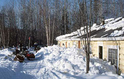
The site was established in 1903 as a Roadhouse & trading post on the mail trail from Fairbanks & Nenana to Nome. Tolovana was the first transfer point in the lifesaving "Serum Run to Nome" in 1925. A relay of dog teams carried diphtheria a…

Stop 13 · Yukon River Corridor

Galena

Located on the north bank of the Yukon River in Koyukon Athabascan territory, Galena connects interior river travel and winter overland routes along the northern reaches of the historic trail network.

Stop 14 · Yukon River · Kaltag Portage

Kaltag

Kaltag is located in Koyukon Athabascan territory, and was used as a cemetery for surrounding villages. It was located on an old portage trail which led east through the mountains to Unalakleet. The Athabascans had spring, summer, fall, and…

Stop 15 · Norton Sound Coast

Unalakleet

Archaeologists have dated house remnants along the beach ridge from 200 B.C. to 300 A.D. The name Unalakleet means "place where the east wind blows. Unalakleet has long been a major trade center as the terminus for the Kaltag Portage, an im…

Stop 16 · Seward Peninsula Coast

Golovin (Chinik)

The Eskimo village of "Chinik," located at the present site of Golovin, was originally settled by the Kauweramiut Eskimos who later mixed with the Unaligmiut Eskimos. Golovin was named for Captain Vasili Golovnin of the Russian Navy. In 188…

Stop 17 · Seward Peninsula

Solomon

The village was originally settled by Eskimos of the Fish River tribe, and was noted on a map as "Erok" in 1900. The original site for Solomon was in the delta of the Solomon River; it became a mining camp. The gold rush during the summers …

Stop 18 · Northern Terminus · Mile 938

Nome

Malemiut, Kauweramiut and Unalikmiut Eskimos have occupied the Seward Peninsula historically, with a well-developed culture adapted to the environment. Around 1870 to 1880, the caribou declined on the Peninsula and the Eskimos changed their…